IDNO
LS.115777.TC1
Description
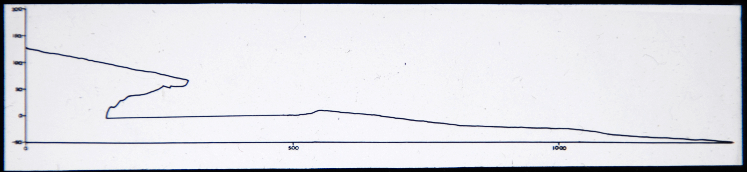
An untitled graph with the Y-axis going from -10 to 200 (units unknown) and the X-axis going from 0 to 1000+ (units unknown). [JD 31/8/2012]
Place
N Africa; Libya; northern Cyrenaica; Gulf of Sirte
Cultural Affliation
Named Person
Photographer
None
Collector / Expedition
McBurneys and Hey’s Expeditions to northern Cyrenaican, 1947, 1948, and 1952
Date
circa 1947 - 1952
Collection Name
Teaching Slide Collection
Source
Format
Lantern Slide Black & White
Primary Documentation
Other Information
Given that they were next to each other in the order the slides were found in, this graph could be showing the elevation in metres above sea level of a cross section of the cave shown in LS.115776.TC1 (the previous slide)? [EMR 31/8/2012]
FM:250427
Images (Click to view full size):