IDNO
LS.115750.TC1
Description
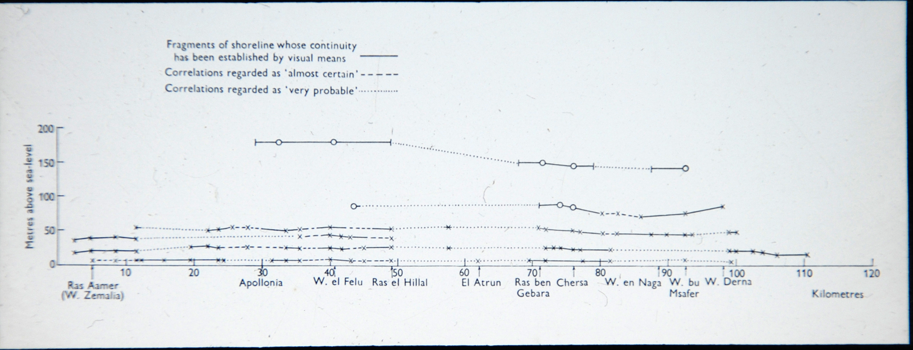
A graph showing the elevation in metres of certain fragments of shoreline (between Ras Aamer [W. Zemelia] and Derna). [JD 31/8/2012]
Place
N Africa; Libya; northern Cyrenaica; Gulf of Sirte
Cultural Affliation
Named Person
Photographer
None
Collector / Expedition
McBurneys and Hey’s Expeditions to northern Cyrenaican, 1947, 1948, and 1952
Date
circa 1947 - 1952
Collection Name
Teaching Slide Collection
Source
Format
Lantern Slide Black & White
Primary Documentation
Other Information
FM:250400
Images (Click to view full size):