Accession No
2003.194
Description
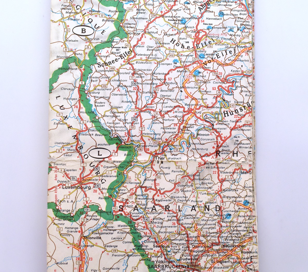
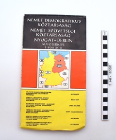
A roadmap of East and West Germany, and small sections of the bordering countries. The map is folded, and has a thick paper cover. The front is black, red, and yellow, with a map of Germany in the middle, and the back is black with white text. 'German Democratic Republic, Federal Republic of Germany, West Berlin, Road Map, 1:800,000' is written in Hungarian in large, white lettering on the upper section of the front cover, and in smaller text in six other languages on the bottom section of the front cover.
Place
Europe; Eastern Europe; Hungary
Period
20th century
Source
Czegledy, Andre [field collector]; Crowther-Beynon Grant [monetary donor]
Department
Anth
Reference Numbers
2003.194
Cultural Affliation
Material
Paper
Local Term
Measurements
255mm
Events
Description (Physical description)
Accession register: 'Map of East and West Germany'.
Event Date 2003
Author: Imogen Gunn (admin)
Description (Physical description)
A roadmap of East and West Germany, and small sections of the bordering countries. The map is folded, and has a thick paper cover. The front is black, red, and yellow, with a map of Germany in the middle, and the back is black with white text. 'German Democratic Republic, Federal Republic of Germany, West Berlin, Road Map, 1:800,000' is written in Hungarian in large, white lettering on the upper section of the front cover, and in smaller text in six other languages on the bottom section of the front cover.
Event Date 2/5/2023
Author: Eleanor Beestin-Sheriff
FM:281481
Images (Click to view full size):